The south shore of the St. Lawrence brings challenges that don’t appear in the textbook. In Levis, the transition from marine clay of the Champlain Sea to the Appalachian foothills creates a layered subsurface that shifts within a single lot. We’ve opened exploratory test pits where the upper three feet looked like standard till, only to hit sensitive clay at depth—material that loses strength when remolded. That’s why a quick borehole alone doesn’t tell the full story. An exploratory test pit lets our team log the sequence visually, measure moisture bands, and take block samples without disturbing the fabric. When the project sits near the Chaudière River or on the upper terraces of Desjardins, combining the pit observations with an SPT drilling program gives us both the tactile profile and the N-value record for bearing capacity.
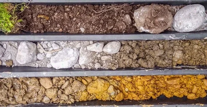
A pit wall reveals what a drill rig misses: the true layering, the oxidized zone, and the water seepage line.
Process and scope
A recent surficial geology map shows much of Levis underlain by glaciomarine deposits, with pockets of coarse fluvial sand along the Etchemin River corridor. That sand can drain fast, but it also collapses in a pit wall if you don’t move carefully. During a typical exploratory test pit here, we’re looking at four things: the thickness of any fill, the depth to the grey Champlain clay, the presence of oxidized crust indicating past exposure, and the static water level. If the clay is soft and we’re within the NBCC 2020 seismic zone for eastern Canada, we’ll often suggest a
liquefaction assessment on the sandy layers below. Our pits are excavated to 3.5–4.5 meters unless bedrock is shallower, and we log every change in colour, consistency, and moisture. The team photographs the face, sketches the profile, and collects bag samples and thin-walled tubes for lab index testing, all referenced to CSA A23.3 for concrete exposure classes when the structure will contact the soil.
Local ground factors
At 46.8 degrees north latitude, Levis endures freeze-thaw cycles that work the upper meter of soil every spring. That’s a problem when an exploratory test pit is skipped and the designer assumes homogeneous bearing. We’ve inspected foundations where a thin crust of stiff clay gave way to soft, high-plasticity silt just 1.2 meters down—the exact depth where a footing would bear. In the older sectors of Lauzon, historical fill containing cinders and brick fragments complicates the profile further. Without a test pit to expose those layers, the geotechnical report becomes a guess. NBCC 2020 requires that the design be based on adequate site investigation; an exploratory test pit provides the direct observation that satisfies that requirement, especially for shallow foundations and retaining structures on sloping lots.
Applicable standards
NBCC 2020 – National Building Code of Canada, geotechnical investigation provisions, CSA A23.3 – Design of concrete structures, exposure classes for sulfate and freeze-thaw, ASTM D420 – Standard guide for site characterization for engineering purposes, BNQ 2501-092 – Soils – Determination of water content and index properties (Quebec reference)
Frequently asked questions
What does an exploratory test pit cost in Levis?
For a standard pit excavated to 3.5–4 meters with full logging and sampling, the range typically falls between CA$680 and CA$1,030. The final figure depends on access constraints, bucket size, and whether we need to manage groundwater inflow during the observation period.
How long does it take to complete a test pit and get results?
The field work—excavation, logging, sampling, and backfill—is usually completed in a single day. We let the pit stand open for at least a few hours to observe water seepage. Lab index tests on the samples add three to five business days before the report is issued.
Is a test pit enough for a foundation design in Levis, or do I also need boreholes?
For shallow footings on straightforward terrain, a well-documented test pit may be sufficient. But if we encounter soft clay thicker than two meters or suspect deeper sand lenses, we recommend adding SPT borings to capture the deeper compressibility profile—the pit and borehole data together give the most reliable picture.
Do you handle the backfill and site restoration after the pit is completed?
Yes. We backfill in lifts, compacting each layer with the excavator bucket, and finish with surface restoration as close to original grade as practical. If the material was wet or sensitive clay, we take extra care with compaction sequence to avoid trapped water pockets.