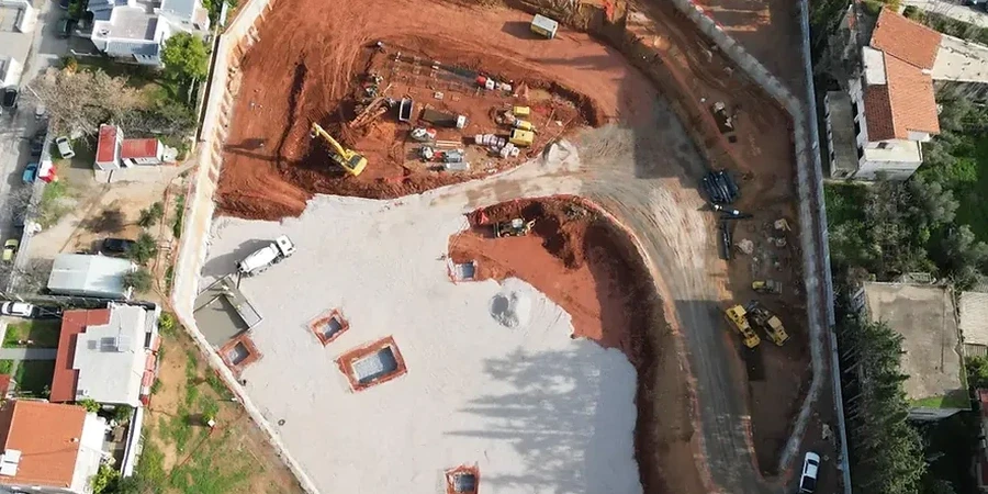
The geotechnical conditions in Levis shift dramatically depending on which terrace you're working on. Up in the newer developments near Saint-Nicolas, you'll typically encounter stiff glacial till and shale bedrock not far below the surface. But down toward the historic Vieux-Lévis district, closer to the river, the soil profile is dominated by sensitive Champlain Sea clays—a material that demands a very different excavation strategy. A cut that holds up easily in the upper terrace can become a complex shoring problem just two kilometers north. Understanding these local transitions is what makes or breaks a deep excavation project. Before opening any major cut in the city, we often recommend a targeted CPT test to map the clay sensitivity continuously with depth, and a seismic refraction survey to confirm the bedrock profile without excessive drilling.
In Levis, the proximity of the St. Lawrence River means that a deep excavation is often a battle against both sensitive clays and fluctuating groundwater levels.
Local ground factors
With a population exceeding 145,000 and growing, Levis is seeing more underground parking structures and utility corridors being pushed into challenging ground. The biggest risk in this city isn't just the depth of the dig; it's the unpredictable behavior of the Champlain Sea sediments. These clays can lose significant strength when disturbed, a phenomenon that was starkly illustrated in landslides across the St. Lawrence Lowlands. An excavation that relies on unsupported vertical cuts in this material can trigger a progressive failure, especially if heavy rainfall or a burst water main saturates the exposed face. The 1996 Saguenay flood, though centered north, was a wake-up call for all Quebec municipalities on the destructive power of water in fine-grained soils. That's why every deep excavation design here must include a solid dewatering contingency and a rigorous peer review of the temporary bracing sequence.
Frequently asked questions
How deep can we excavate without encountering groundwater issues in Levis?
It varies significantly by neighborhood. In the elevated areas of Saint-Rédempteur, you might find the water table 10 meters down within the till. However, in the lower terraces near the river, like the Saint-Romuald sector, groundwater can be encountered at just 2 to 3 meters below grade. A hydrogeological study early in the design phase is essential to map seasonal fluctuations.
What is the typical cost range for a geotechnical excavation design package in Levis?
For a comprehensive geotechnical design of a deep excavation, including site investigation, laboratory testing, and shoring analysis, the fee typically ranges from CA$2,570 to CA$9,790. The final amount depends on the depth of the cut, the complexity of the soil profile, and the level of instrumentation specified for the monitoring plan.
Do we need to worry about the sensitive clays if we are excavating in rock?
If your excavation is entirely within the competent shale bedrock, the clays are not a direct concern for the cut face. But you still need to consider the global stability of the slope above the rock line. Many sites in Levis have a layer of clay overburden, and if that overburden slides, it can compromise the crest of the rock excavation.
What is the process for obtaining a permit for a deep excavation in Levis?
You'll need to submit a detailed excavation plan stamped by a Quebec-licensed engineer to the Ville de Lévis. The plan must demonstrate compliance with the Quebec Safety Code for construction and address any impacts on public rights-of-way. If the excavation is near a watercourse or in a landslide-prone zone, a geotechnical report addressing slope stability is also mandatory.